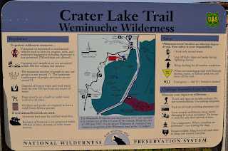
The hike to Crater Lake offers beautiful views of the surrounding San Juan Mountains through rolling terrain, high alpine meadows, pine glades and to the base of Twilight Peak. It is a high altitude hike that will get your heart beating as the hike starts at an elevation of 10,750 feet and climbs to 11,700 feet. It is doable as a rigorous day hike but there are a number of nice campsites around Crater Lake for those looking for an overnight hike and camp out.
Directions: From Durango, head north out of town on Highway 550 for about 40 miles to Andrew's Lake, which is where the trail head is located. The road to Andrew's Lake will be on the right (east) side of the road after going over Coal Bank Pass and as you begin to climb towards the top of Molas Pass. Look for the sign and follow the road to the lower parking lot.
 |
| View north from Snowdon Ridge. |
Trail: From the lower parking lot at Andrew's Lake, follow the concrete path next to the bathrooms over the bridge until you see a hiking trail veer off to the right and uphill. Follow this trail to a large sign and a registration book for the Weminuche Wilderness. Register and proceed up the trail, which begins to climb through a number of wide switchbacks. Once you reach the top of this first ridge, you will have great views of Snowdon Peak to the east, along with a number of lakes and high alpine meadows. The trail heads south from the top of the ridge line and begins to descend for about a mile.
 |
Trail heading through meadow with
Twilight Peak in the background. |
At about the two mile mark, the trail begins a short steep climb as it enters into the Weminuche Wilderness Area. After this climb, the trail gets a bit rough and was quite muddy in places crossing over a number of small streams. The trail then goes through some rolling terrain before it climbs once again to another ridgeline through the pine trees. From here the trail descends and crosses over Three Lakes Creek. After crossing the creek, the terrain becomes rolling and the trail travels through a number of meadows offering great views of Engineer Mountain to the west and the Twilight Peaks to the south. The trail heads back into the woods, climbs through a blow-down area and then reaches a crest before heading down into a number of high-alpine wetlands.
 |
| View of Engineer Mountain to the west. |
After moving through this area, the trail descends again to Crater Lake. There are plenty of campsites around Crater Lake, just make sure to stay at least 200 feet from the lake. I saw a number of fish jumping in the lake and pika running around in the nearby rock fields. There are a number of trails around the lake that are great for exploring the area. My out and back hike was a total of 13 miles and took about five hours, but I spent quite a bit of time at Crater Lake having lunch and exploring the area.
 |
| Crater Lake |
 |
| Map of hike. Started at left at Andrew's Lake and ended at right at Crater Lake. |
 |
| Elevation Profile |


